Award-Winning Student Map Aims to Help Southern California City Plant a Sustainable Future
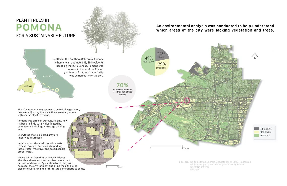
The 2022 Data Visualization Challenge award-winning 'Plant Trees in Pomona for a Sustainable Future' poster by Irene Pineda
Currently dominated by commercial warehousing, Pomona, California used to be home to luscious agricultural landscapes. The city was even named in honor of the Roman goddess of fruit for its fertile soil. Due to industrialization, however, the city has lost much of its charm, and that loss has drawn the interest of Irene Pineda '22 MLA.

Irene Pineda '22 MLA.
Pineda, who graduated from the Master of Landscape Architecture program this spring, created a visualization map to envision a return of the city’s rural character. Her research and creative work resulted not only in a plausible long-term plan, but an award. Pineda placed first in the graduate/professional category for the UArizona Libraries 2022 Data Visualization Challenge for her map submission, Plant Trees in Pomona for a Sustainable Future.
For the third year in a row, UArizona Libraries held the annual data visualization challenge to highlight how UArizona students use visual displays of data—maps, charts, graphs, data art and 3D models—to tell stories.
“As a landscape architecture student, one of our required classes was Introduction to Geographical Information Systems,” says Pineda. “Professor Philip Stoker encouraged me to apply for this challenge, as he felt my design was clear and comprehensive.”
The GIS assignment required students to gather publicly available data and display it in maps. Pineda’s project examined several data sources for Pomona, California, where her parents currently reside.
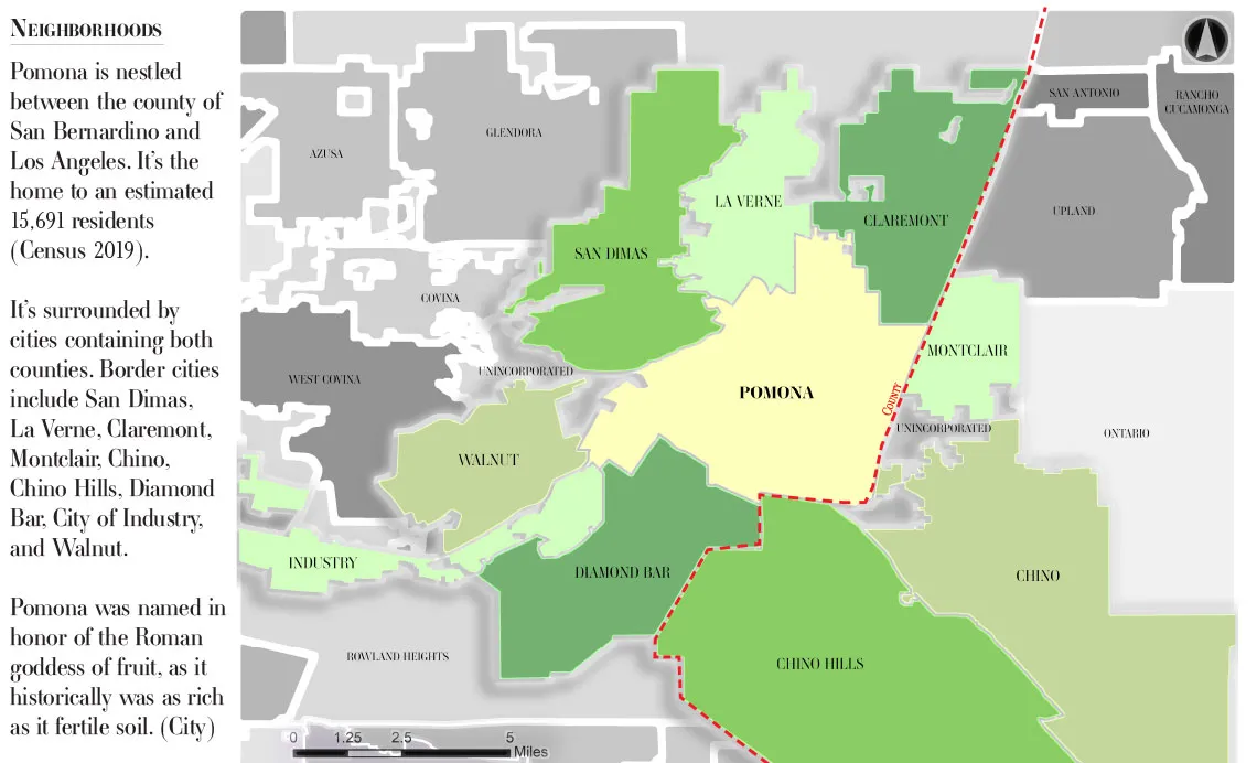
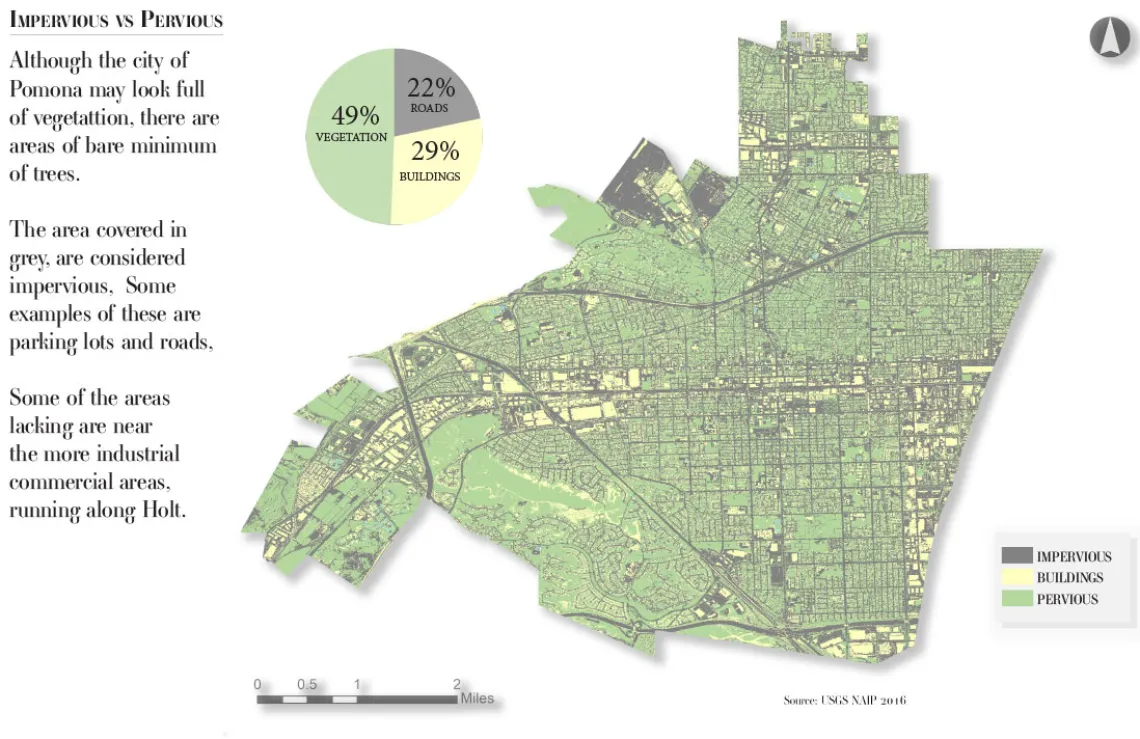
In comparison to its Southern California neighbors, Pomona’s streets lack shade. Because there has not been much new housing development, demand for cheap commercial real estate has soared. What used to be a rich agricultural town has become a hub of parking lots, corporate buildings, traffic and rising pollution.
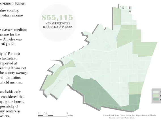
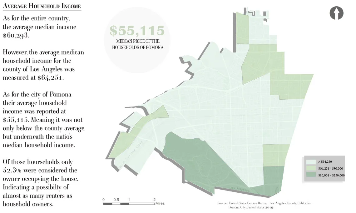
“When looking at Claremont, which borders Pomona, there’s a notable difference in street aesthetics. Just because the cities differ in median household income, accessibility to walkable streets and nature should not differ between the two,” says Pineda.
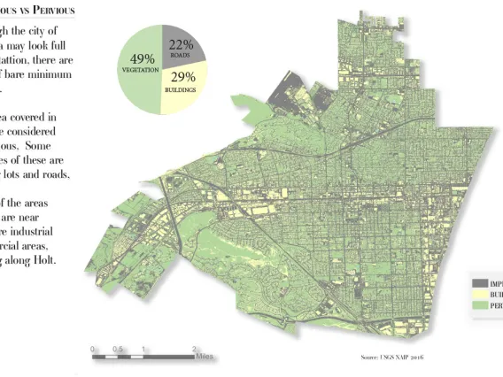
“Irene’s work demonstrates effective visual communication, utilizing high-quality data sources and a balance of informative text and appealing imagery,” says Stoker, an assistant professor of landscape architecture and planning. “The map illustrates land cover derived from the National Agricultural Inventory Program and was classified and created in GIS.”
Her winning entry identifies where trees should be planted to provide more shading. “Impervious surfaces are absorbing and re-emitting the sun’s heat more than natural landscapes,” she says. “Trees help cool the environment and bring the city a step closer to sustaining itself for future generations.”
“I have high hopes of seeing Pomona turn its priorities towards citizens like my parents by providing them access to nature. Pomona has the potential to become as fruitful as it once was.”
Map Gallery
View more maps by Pineda created for her GIS for Landscape Architecture and Planning assignment:


